

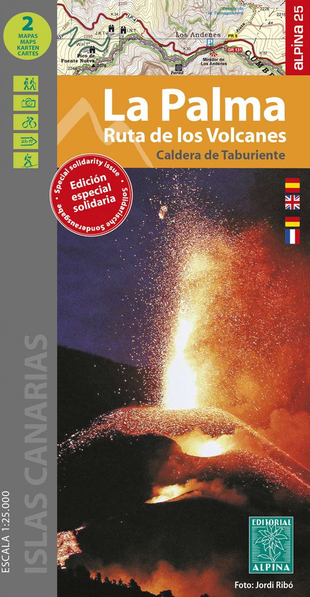
ed. alpina La Palma Ruta de los Volcanes Solidario
14.00 €
Estimated delivery 29 Apr 2024
.
.
-
 Free click and collect
-
 Finance your purchase
Features ed. alpina la palma ruta de los volcanes solidario
Folder with 2 hiking maps from Editorial Alpina, focused on the area of the Ruta de los Volcanes in La Palma.
The map is presented in a practical folder that allows easy access to the map. In the map folder you can find practical information on telephone numbers and addresses of refuges and hostels. It includes all the paths and paths, as well as a list of cavities with the number, name, slope and route.
Editorial Alpina, specializing in hiking maps, wanted to contribute with this special edition of the map of La Palma to the disclosure of the magnitude of the catastrophe caused by the volcanic eruption. Its solidarity and that of its users will allow €1 to be allocated for each map sold to help those affected by the eruption.
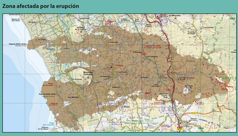
The volcanic phenomenon lasted 85 days and was the longest eruption recorded on the island. The lava flows destroyed 2,988 buildings including the town of Todoque and most of the 7,000 people evacuated lost their homes. Thicknesses up to 60 meters high covered 1,219 hectares and buried numerous roads and banana plantations. Two flows reached the sea and created two new peninsulas,
known as fajanas or lava deltas, of about 50 ha. long and about 500 m wide.
In January 2022, different toponyms are being considered for the Cumbre Vieja Volcano. The most likely is Tajogaite which means "Cracked Mountain" in the language of the aborigines of the island, the Benahoaritas, and is the name of the place where the eruptive process began.
On the other hand, the area affected by the volcanic eruption from September 19 to December 13, 2021 has been delimited.
Features:- Special solidarity edition, donation of €1 to help those affected by the eruption.
- 2 Maps 1:25,000 + Expanding folder.
- Affected area delimited by the volcanic eruption from September 19 to December 13, 2021.
- Top 10: points of interest.
- Map measurements: 120 x 88 cm.
- Information of hiking, ethnographic and tourist interest.
- Vegetation representation + shading.
- Network of trails and services.
- UTM coordinates.
- Languages: Spanish, English, German and French.
- ISBN: 978-84-8090-910-5.
Discover more products